

See the actual ground before booking a trip.
We build 3D property models from provincial mapping data so buyers can check the slope and house site on their phone.
What it is
Browser-based 3D models built from public mapping data
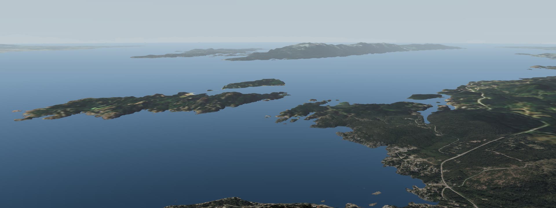
Erevna Labs builds 3D land models that open in any standard web browser on a phone, tablet or desktop computer. Nothing needs to be downloaded or installed. Each model combines British Columbia's 1 m airborne LiDAR elevation scans, government aerial photography and registered parcel boundaries from ParcelMap BC.
Standard photos and videos show the surface appearance of a listing. A 3D model shows how the site works. You can stand on the terrain at eye level, review building ground on a slope map, check tree canopy heights, and follow the sunlight across the property through the day.
 Open the live model ↗
Who uses it
Who it's for
Realtors selling land, acreage or waterfront
Buyers living in other regions can walk the parcel, the shoreline and the building site online before booking travel. It's a clear step between looking at listing photos and visiting the property.
Owners and buyers asking "What can I build here?"
Landowners and buyers can look at building locations, slopes, setbacks and access routes on one screen before paying for site design work.
Land developers
Developers can show lot layouts, road networks and development phases on the actual terrain, so buyers, partners and planning staff all see the same thing.
Access, easement and boundary questions
Property owners and their advisors can review access routes, right-of-way alignments, registered boundary lines and sightlines using sourced mapping visuals.
For large rural parcels, tree height measurements give a standing-timber picture, though a forester's cruise is still needed to determine wood volume and commercial value.
Examples
Examples
Click and drag either sample below to turn the terrain and see how the 3D ground sits.
What's in a model
What you see in a model
Eye-height walking
Stand anywhere on the parcel and look at the surrounding landscape at normal eye level.
Slope map
Gentle building benches and steep or rocky ground, each in its own colour shading.
Sun slider
Move the slider to see light and shadow across the property at any time of day.
Measured trees
Tree canopy heights and overall forest cover recorded by the Province's airborne LiDAR.
Property line
The registered ParcelMap BC boundary laid directly onto the 3D terrain.
Guided tour
A short walkthrough of the key property features, access routes and views.
What the research says
What the research says
A virtual tour shortened the time a house was listed for sale from 34 days to 19 on average, with no change in sale price.
University of Texas at Dallas, peer-reviewed study in Information Systems Research, 2025Visitors who view videos and virtual tours are 27% more likely to reach out to a REALTOR®.
Canadian Real Estate Association (CREA), REALTOR.ca, 2019Homes with a 3D tour sold 10% faster, were saved by buyers 32% more and got 29% more views.
Zillow, from its own listing data, March 2021These studies are about houses. We haven't found a published study on 3D models for land yet.
How it works
Three steps
Send the address or PID
Give us the parcel address or Property Identifier number to begin.
We check the data and quote
We check the provincial mapping data available for your parcel. Most settled areas in southern British Columbia have 1 m airborne LiDAR.
You receive a private link
We deliver a private, hosted web link to your model, usually within one week.
Prices
Prices
Where the data comes from
Data sources and limits
Our models are built from official public datasets: British Columbia's open 1 m airborne LiDAR elevation scans, regional and provincial aerial photography, and registered parcel boundaries from ParcelMap BC. Every data source is cited in the model.
These models are visualization tools, not a legal survey. Boundary lines are shown for general reference and are not established by a BC Land Surveyor. Tree canopy measurements give structural context but don't replace a professional forester's timber cruise. If provincial airborne LiDAR isn't available for a property, a drone flight can be arranged at cost to capture surface photos and terrain shape.
Questions
Questions people ask
Where does the data come from?
Models are built from British Columbia public records: 1 m airborne LiDAR ground elevation scans, regional aerial photos (orthophotos) and ParcelMap BC registered parcel lines.
Is the model a legal survey?
No. Boundary lines come from registered parcel records for general location reference. They don't replace a legal boundary survey by a BC Land Surveyor.
Does it work on phones and tablets?
Yes. The model opens in standard web browsers on iPhones, Android devices, tablets and desktop computers without installing extra software.
How long does delivery take?
Most listing models are delivered as a hosted private link within one week of order confirmation.
What if there is no provincial LiDAR for my property?
If provincial LiDAR doesn't cover your parcel, we can organize a drone flight at cost to capture current aerial photos and the ground surface shape.
Who owns and hosts the model?
Erevna Labs builds and hosts the model on our servers. Clients receive a private link they can share for marketing and site evaluation throughout the hosted period.
Contact
Tell us the address or PID
Send your parcel address or PID. We'll review the public mapping data available for your property and send a quote.